"Where does Marina from finance sit?" feels like a trivial question right up until the company outgrows a single floor. After that it's the familiar scene: a new hire walking the open plan with someone's photo on their phone, and a department move that costs forty messages and a seating chart drawn in a slide deck.
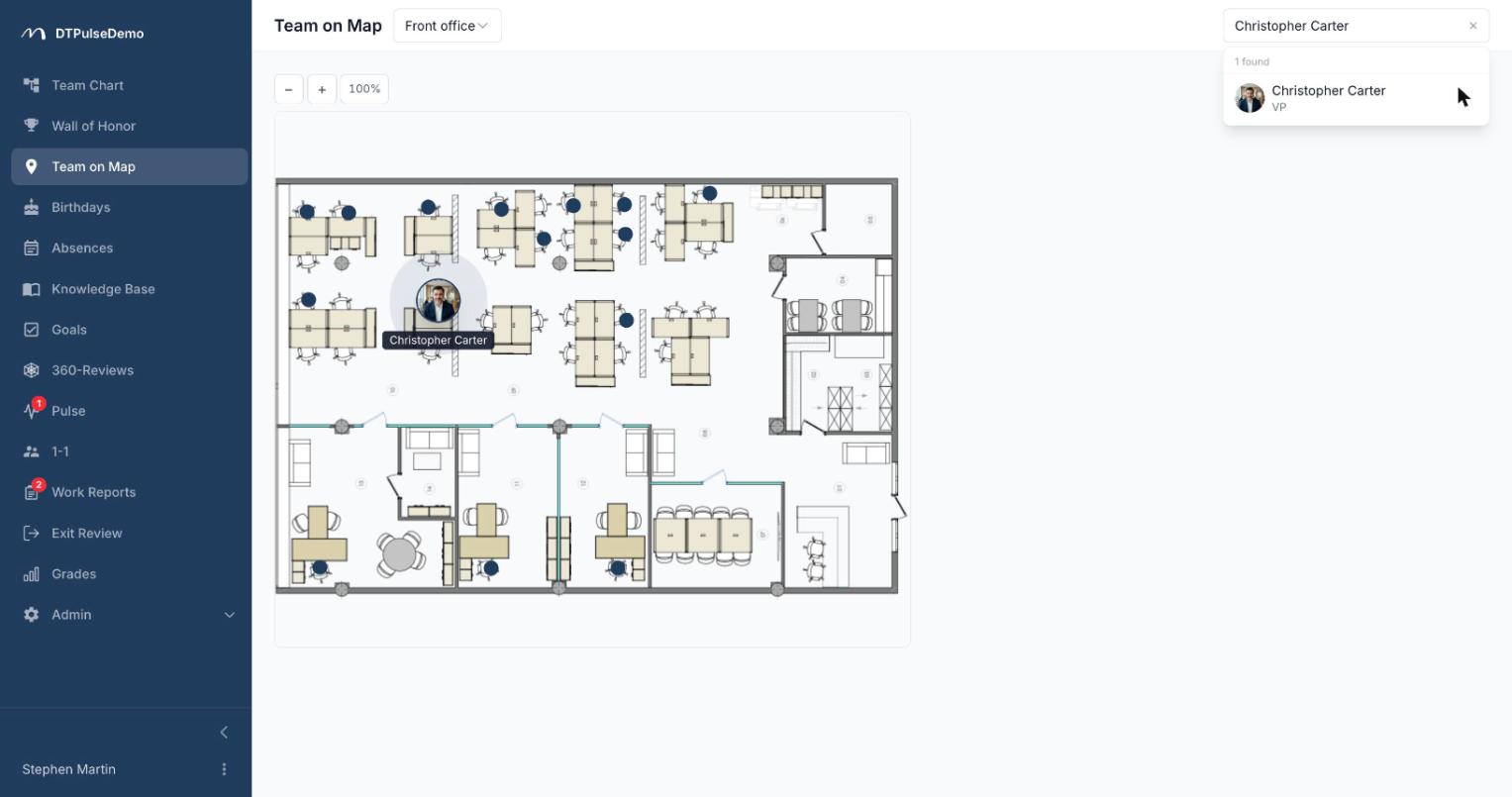
The office map solves this in a boring, reliable way: you upload a floor plan, place the seats, assign people to them. From then on anyone can look a colleague up by name and see a dot on the plan.
Floor plans
Plans are uploaded as images — PNG or SVG, the same file your landlord or office designer handed you. Nothing needs redrawing.
Seats are placed on top of the plan with the mouse. Coordinates are stored as percentages of the image dimensions rather than pixels, so the map renders correctly on a monitor and on a phone alike, and nothing drifts out of place if you later swap in a higher-resolution version of the plan.
You can have as many floors as you like; a floor switcher appears as soon as there's more than one. Clicking a seat opens the profile panel for whoever is assigned to it — the same details as in the org chart: job title, department, contacts, absence status.
Finding a person on the map
Search here doesn't mean "find and highlight in a list", it means "show me where they are". Pick a person and the map opens the right floor and highlights their seat. A link to a specific person on the map can be pasted into chat: it opens straight to the correct floor.
Geo view for distributed teams
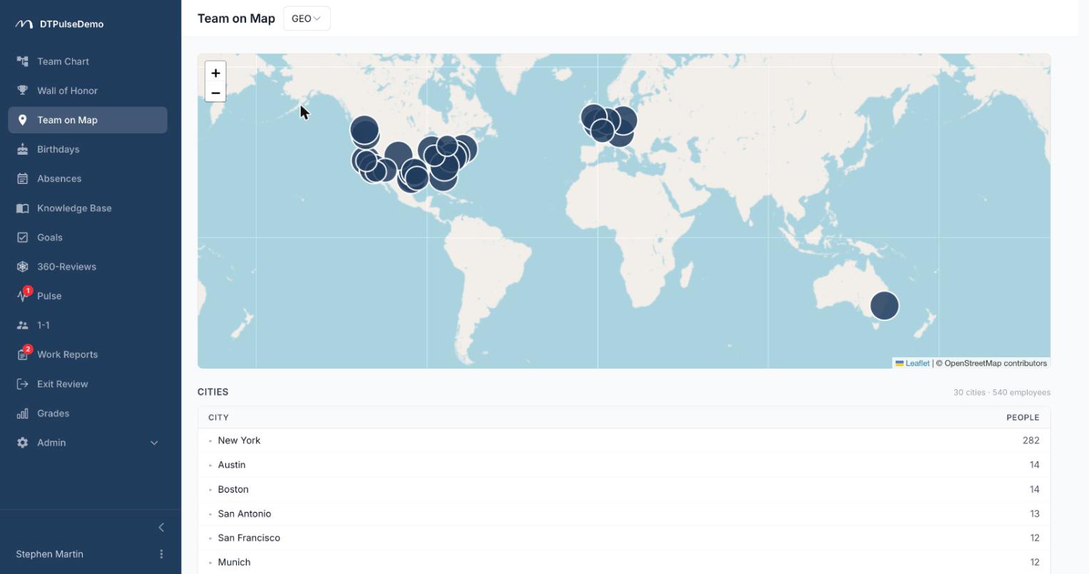
If there's no office as such — or more than one — the map works in geo mode, showing people on a world map by city. For companies with no floor plans uploaded, this mode turns itself on with no configuration.
Geo view answers the questions that come up constantly in a distributed team: how many of us are in each city, which time zones colleagues work in, whether anyone is close enough to meet in person. Cities come from employee records, whether entered by hand, imported from CSV, or populated through SSO.
dtpulse.com renders the map with OpenStreetMap. For an on-premise deployment this matters: the mapping service is the one external dependency this section has, and it's chosen to fit your security team's requirements.
Whose time this saves
New hires get a first day without the "and over here we have…" tour. They can find anyone themselves.
Office managers stop running department moves over email. Seats are reassigned in the interface, and everyone sees the current layout the same moment.
Managers of distributed teams know who is in which city and time zone without maintaining a separate spreadsheet.
The company gets an honest picture of how many desks are actually occupied. That's the first real input to the conversation about whether you need another floor.
How it connects to the rest of the portal
The map isn't a separate tool — it's another view of the same employee records. Hire someone and they appear on the map as soon as you assign a seat. Put them on holiday and their card shows the absence. Off-board them and they disappear from both the tree and the map at once, with no manual cleanup in two places.
Getting started
Upload a floor plan in the admin area, place the seats, assign people. For a fifty-desk office that's half an hour of work. If you don't have an office at all, do nothing: geo view switches itself on as soon as people have cities on their records.
The office map is available on every plan, including the free tier for up to 10 people.